country (like I wanted to) vs. doing tamer activities. We decided the
day before not to buy tickets so that we can make up our mind in real
time. We woke up late (around 10am) and it was raining heavily. After
breakfast we debated what to do. We were not enthusiastic about hiking in the cold rain (as we don't have rain proof jackets and pants). So
we decided to find other activities. At the end we decided to try to
drive the first 15 miles of the road ourselves and see if we can spot
wildlife. We pack the RV and set out. It was raining and we drove the
whole 15 miles without seeing a single animal. At the end of that part
of the road there is a river with a trail next to it, but it was
raining so hard there that going out was not something we looked
forward too.
We did have time for Roy to photograph a wet seagull in the tail head
parking lot
We drove back to the campground and decided to save the day and do
laundry. We also took showers, and after two hours were clean and had
many dry clean cloths. We decided that the weather is not going to
improve, and so instead of staying another night, we took our chances
and drove the Denali highway, which will be the subject of the next
chapter.
And so we left the great Denali behind us. During our time in the park
the mountain was covered by cloud, so we only got to see it from the
plane the day before. The wide spans of wilderness impressed me a lot.
To fully experience the place I guess one need to stay several days in
the backcountry camp sites and do some hiking there to get a feel of
the land. Maybe next time....
Parting views from Denali
road connecting Denali to the eastern parts of Alaska. It used to be
the only way to reach the park until the Anchorage to Fairbanks
highway through Denali was opened some 20 years ago. Since then the
Denali Highway is mostly deserted. The highway is known for being
rough (it is not paved, but rather a hard dirt road) and going through
wilderness areas.
We set in the afternoon. Since we didn't have lunch, we decided to
stop for a snack on the road. We found a place that was open. It was a
pub/pizzeria local place run by two local boys and it seems that
several local people come in and out for playing video games and
chatting. We ordered a pizza, and at the last moment decided to also
order cheese sticks. Turns out that cheese sticks is a pizza without
the sauce :-) The food was pretty good. Full of dough we set out on
our way.
After a few miles we turned left (east) onto the Denali highway. The
first few miles were paved and this was like a standard route. Then
suddenly the road became a dirt road. The whole RV started to vibrate
and shake. We stopped and re-secured everything as best as we can, and also switched drivers (as Yael is a more careful driver than I am).
Still it was a noisy affair, and every now and then we got into a
stretch where the road was a collection of small holes and it felt
like we were trying to shake the RV into small pieces. Although we
initially thought about turning around, at some stage we got used to
the racket and ploughed on. We were traversing an area of hills with
spruce forest around us.
Start of Denali Highway
After a while the road started to descend and the forest intermingled
with tundra. We passed many small lakes and pools with small streams. In one of these pools, just next to the road we spotted a female moose
grazing on aquatic weed.
Female Moose
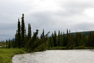
We continued and came next to river (that we met downstream next to
entrance to Denali Park. At the river bend we could see a phenomena we later saw also elsewhere -- trees whose footing is slowly eroded by the
river and they start slope inwards (until they eventually topple and
get swept away downstream).
Toppling trees
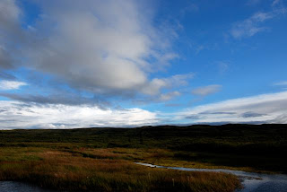
As we progressed the weather cleared up and we could see more and more blue sky. Up ahead large mountain ranges framed by impressive sky. The road was not deserted, we run across a car every now and then, but
most of the time it was just us and the road. The scenery kept
changing and both Yael and me where struck by the beauty of it. The
kids were less interested...
Big big sky
It was starting to get late in the evening with the sun low behind us.
Yael spotted a big eagle sitting atop a tree just off the road, and we
stopped and watched it for a while.
Eagle
We continued until the road turned closed to a big river. Here was our
intended destination, the Gracious House a restaurant/camp ground/
cabin lodge/air strip/car repair/gas station combination. We turned
the road into the drive way of this group of houses, and the whole
area seemed deserted. We followed the sign to the camp ground and saw that it was empty. I got out of the car and searched for signs of
life. Eventually a woman came out of one of the houses and told me to
camp and settle the bill in the morning. We camped in a nice grass
spot with a fire ring and picnic table. The whole area was think with
mosquitos and so we dug out the special bug repellent bracelets that
we packed in several layers of ziplock bags due to their strong odor.
Roy and I went for a walk back along the way. It was dusk time and as
we were walking we spotted a rabbit just ahead of us. Roy stopped and
photographed it.
Rabbit at dusk
As he did that, I realized that when we are not walking or talking
there is deep silence around us. After the racket of the RV ride, it
was impressive to realize how quiet the wilderness is here. We went
back to the RV and started a fire. This was the first time we had the
opportunity to sit outside in the evening camp. We open the folding
chairs and got Yael and Lior to emerge from the RV. As Roy tended the
fire, both Yael and Lior worked on their wood carving skills. I
prepared a late dinner of hotdogs and corn, which we ate outside, and
then the kids prepared marshmallows over the fire. We went to sleep
late and satisfied.
Evening sky (entrance to Gracious House)
Map:


No comments:
Post a Comment